HJA Andrews Temperature
Mapping Project
Jonathan W. Smith
Research Assistant
Spatial Climate Analysis Service
322
(541) 737-8970
OVERVIEW OF THIS PROJECT
This
project is a master’s thesis in the Department of Geosciences at
Click here to view the thesis abstract.
Any questions or comments about
any items herein should be directed to the author at smithjw@coas.oregonstate.edu. This site is best viewed using Internet
Explorer.
Click on the appropriate link to view the following:
Text of thesis.
Bibliography for this thesis.
Project research proposal.
Description of the end products and what makes the project unique among temperature interpolation studies.
Thesis defense presentation (click here to download powerpoint file).
Mean monthly maximum and minimum temperature maps and GIS grids, adjusted and unadjusted for radiation and sky view factor effects.
Radiation maps and GIS grids of the HJ Andrews.
Temperature datasets for all HJ Andrews sites, past and present.
Data list (dates of sensor operation and dates of processed data) for all sites in HJ Andrews LTER network.
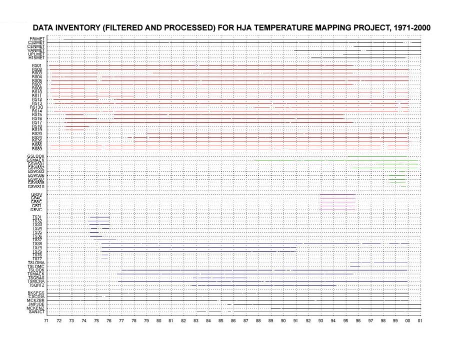
Data inventory (chart) of max & min temps for all sites in HJ Andrews LTER network.
A list of sensor heights for all sites in HJ Andrews LTER network.
Detailed site summaries of each site used in the study (radiation regimes, canopy characteristics, etc).
Other useful tables.
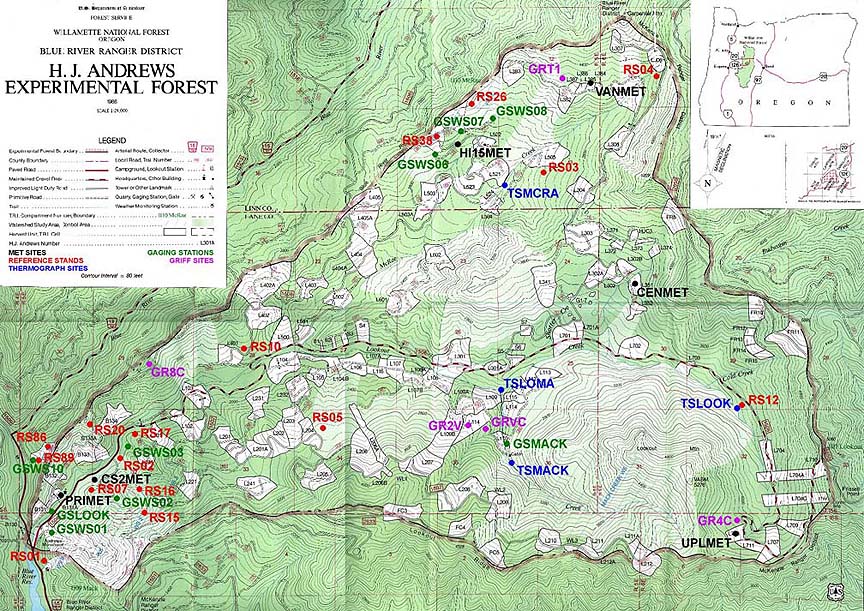
A map of the HJ Andrews with locations of all sites used in the study.
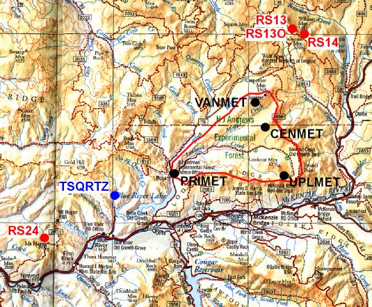
A map of the surrounding area showing sites outside of the HJ Andrews in the LTER network.
Panoramic images and other photographs of sites in HJ Andrews LTER network.
Fisheye photographs taken at climate stations, past and present.
RELATED STUDIES AND GENERAL HJ ANDREWS CLIMATE CHARTS
PRIMET and CS2MET temperature and precipitation comparisons
PRIMET, CENTRAL, VANILLA, and UPLO precipitation comparisons
Historical climate charts for PRIMARY, CENTRAL, VANILLA, and UPLO met sites
Historical temperature charts for reference stands, thermograph sites, and met sites
LINKS
Department of Geosciences, Oregon State University
This site was last updated on June 25, 2002.